GDAL library allow import raster images of GIS terrain models.
Read of Arc/Info, tiff, jpeg, png and most raster formats as structured quadrilaterals.
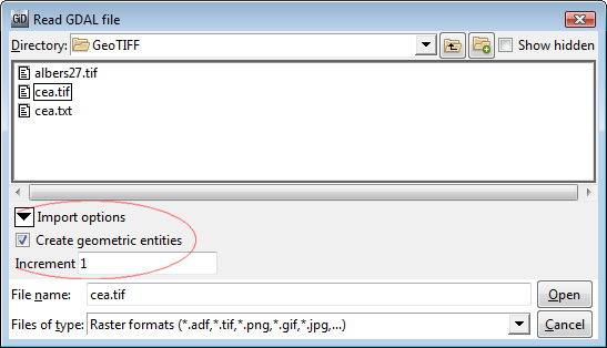 |
Options to import as geometry or mesh, and subsampling big files.